The upper end of this trail follows along the old airstrip itself with a nice view - unfortunately this can be awful on a hot, sunny day. The lower end of the trail is brand-new; winds down the dry slope below the airstrip on a moderate grade with...
Of the two loops in the park, this one feels more fast and flowing, but it has some twisting sections too. Up-and down the hills all the way around. This is where the yellow-blazed M3 loop begins, with a short out-and-back section at the beginning....
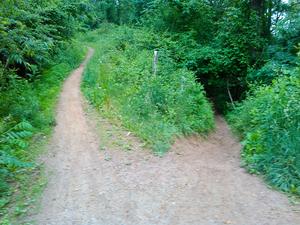
The more tight-and-twisty of the two loops at Alexander MTB Park. However, it's not extremely so and there are some fast sections too. Riders are asked to go counter-clockwise on this loop, and it's mostly well-signed and easy to follow. The trail...
Most prefer to make this a descent - you can use gravel roads in the area to do the climbing. Touches up with FS 5057 making connections over to Buckhorn Gap possible. Very steep, rocky, and technical at the northwest end. Passes through a thinly...
Travels from the horse barn near Bridal Veil Falls, past the scenic pastures, and uphill past a small creek to join with the Shelter Rock trail near the bottom of the Airstrip trail. Quickest way to get from the airstrip (and Fawn Lake parking area)...
Going uphill, starts in a clearing, and then becomes a fairly technical and moderately steep route. Recommended direction is downhill, however, and you can make a nice loop using FS 5001 (a gated logging road).
Rough trail makes a fun, rocky and muddy downhill connection between the Laurel Gap trail (grassy road) and FR 74. Not that great uphill - there's no real good downhill to connect to unless you come back down this trail. Huge jumps near bottom. A...
Most people ride this downhill, and for good reason - it's a blast, with a mix of technical, ridge-top and sidehill flowing sections. Some spots near the intersection with Perry Cove Trail have nearly sheer drop-offs on the downhill side of the (very...
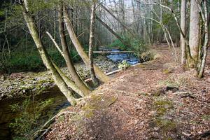
Follows one of the larger tributaries of the North Mills River. Many creek crossings on the lower half. Steep climb up the Pisgah Ridge on the upper half. High elevation change. Carry bikes across Blue Ridge Parkway property.
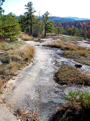
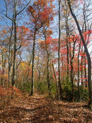
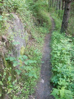
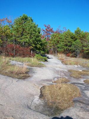
Trail is rocky and moderately rough at the lower end; offers a fairly gnarly descent or technical climb. Passes over the granite dome, and offers some great slickrock. There are some great views toward Pisgah from the middle. Winds thru pine/oak...
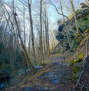
This heavily-used trail features incredible views, riding along a needle-sharp ridgeline, and lots of rock outcroppings and boulders. The trail itself is notable for its waterbars, switchbacks, and (unfortunately) heavily eroded sections. Either...
Somewhat steep in places; eroded sections. Nice ridge-top ride providing options for some longer loops on the north side of Panthertown. Combine with Powerline Road and North Road (both more like singletrack to doubletrack trails) to make a nice...
Represents the easiest route in the park, all on old road beds. This is a "lollipop" loop, or a loop with an out-and-back extension from the parking area to the disc golf area. Most segments are shared with either Blue or Yellow loop trails. Climbing...
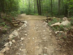
Easy, hardpacked trail with an easy, armored rock creek crossing on the upper end. From Boyd Branch Road to the creek crossing, the trail has been graded and graveled, smoothing out a formerly rocky, rooty stretch. The creek crossing itself is no...
Fun creekside, backcountry trail. Numerous water crossings (the deep, rocky, wading type). Good trail for a hot day. Log after log after log across the trail (touch up on your bunny hopping skills!). At some of the creek crossings, it is difficult to...
Now the Little River trail.
Mostly level, some sandy sections, some hardpack, a few rocks. Follows river. Creek crossing. Part of the Eastern Slickrock Best Ride.
Gravel road occasionally used by forest service vehicles. Passes the horse stables and terminates at a loop, where a short path continues around a switchback to an overlook, and then the base of Bridal Veil Falls.
Gated, wide, maintained gravel road occasionally used by park and private vehicles (by permit) on the western end down to the Grassy Creek bridge. Rest is fast, packed doubletrack on an old unmaintained road bed.
Many creek crossings on the lower end and then it's a stiff, moderately technical, rocky climb to the gap. Some eroded places and waterbars. Merges with and follows a gravel road near the top. Not ridden N. of Buckhorn Gap down to S. Mills R. See...
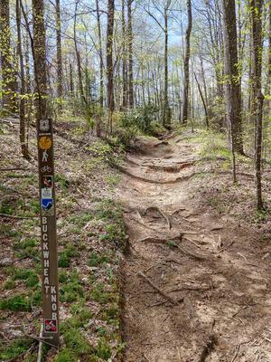
Ridgeline trail which passes some enormous trees. Very steep and technical on south end with switchbacks, waterbars, rocks and roots. North of Buckwheat Knob, the trail is narrow, somewhat less steep, and moderately technical. Passes through...
This trail, which doesn't really have a name per se (other than "the loop trail" or "trail: phase 1") is a newly-constructed, machine-built path. It's rather wide, but it was built to accommodate multiple uses (bikes and hikers). It winds through...
Southeast end is mostly on an old road bed, high above the Little River at first, undulating and fast. Then switches back and climbs up near the nondescript summit of Burnt Mountain, flowing on and off the old road bed. Steeper descent on northwest...
Seasonal Use Only. Beautiful scenery, fun trail. Starts in Picklesimer Fields...flat, grassy area with crystal clean streamside riding, then a fast, gradual climb, and then a stiff, technical climb up to Butter Gap. Also makes a great downhill from...
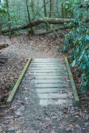
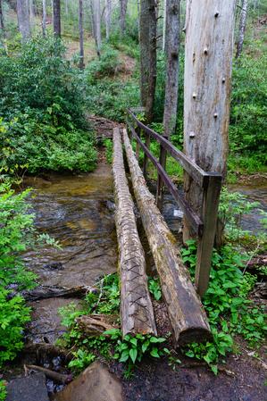
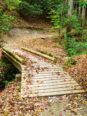
Connects the Bent Creek Campground with Bent Creek Gap Road. A smooth, level old roadbed which follows Bent Creek part of the way. Interpretive signs. Mixed pine-hardwood forest. Nice bridge right before intersection with Bent Creek Gap Road.
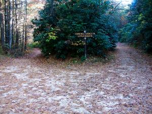
In what has to be one of the worst naming decisions in the Pisgah district, the part of this trail which is open to bikes *really* should be Cove Creek. Then, Cove Creek would be open to bikes, Caney Bottom wouldn't, and all would be right in the...
Connects the South Mills River trail with the middle of Squirrel Gap trail. Starting near the old Cantrell Creek Lodge site, the trail follows Cantrell Creek upstream on the river right side to where the former trail continues upstream (now part of...
Seasonal/partial use trail; the portion from the Fish Hatchery up to the Butter Gap trail is open to bikes from October 15 - April 15 only. Fairly technical in spots, but more sections are level and fast, with jumps and waterbars in places. Has some...
Don't miss this one! This trail offers some of the best - and only - slickrock riding in the East. Combined with Big Rock, this covers most of the slickrock in Dupont. Long sections of solid, rough granite are interspersed with patches of trees,...
Follows an old road past an old cemetery on a little plateau near the Davidson River. Lots of white pines & hemlocks, & mountain laurel groves. Some doubletrack & some singletrack; pleasant, short loop.
No unavoidable obstacles. All-access trail to other optional trails. Provides glimpses of the lake at times but the side trails take you closer. Mostly smooth singletrack with a few sections on reclaimed logging roads. The steepest section - although...
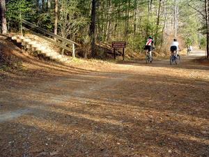
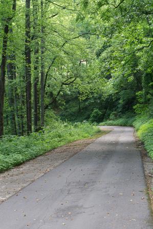
This is a wide, graded, maintained gravel road, which is gated but occasionally used by park vehicles, and private vehicles for visiting the waterfalls (by permit). Passes the old airstrip.
Only the east half of the loop is open to bikes (and only seasonally). It's moderately steep and rocky; makes for either a fun downhill or a pretty serious climb, especially near the top. A few creek crossings/wet areas can be found near the bottom....
Mostly hardpacked, rolling doubletrack, but there are some areas with rocks and bigger gravel, as well as some sand and highly eroded sections. It's becoming singletrack in places. Starting at the Corn Mill Shoals parking area, the trail undulates up...
This is an old road bed which goes around the Cove Creek group campground and all the way up to FS 225B. In one of the worst, most confusing naming decisions on the Pisgah district, the lowermost portion of this route south of the Caney Bottom trail...
A terrific, moderately steep, rocky, and technical loop trail. Described here clockwise, it can be ridden either direction.
Follows an old roadbed upstream at the start. Passes an old fish hatchery; starts climbing moderately and becomes quite...
Near the fish hatchery, this is a fun but gradual downhill W to E with jump after jump and the river is far down in the gorge below. Also bypasses a terrible, dusty, hot, sunny climb on FR 475 in either direction. Several landslides in September of...
Starting at the Panthertown Valley trail downhill from Salt Rock, this trail descends to cross Frolictown Creek just above its small, scenic waterfall. Be careful at the crossing - it's slippery and the falls are just downstream. The trail is an old...
Short, but fun loop. Have a few extra minutes after your longer ride at Bent Creek? Hit this one for a nice finish. Steep in places; passes a small wildlife opening. Mostly doubletrack on old roadbeds but one section is true singletrack on the side...
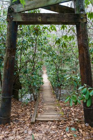
Starting at the Rice Pinnacle parking area, the trail is paved up to the former Deer Lake Lodge site and crosses a long wooden bridge along the way. Beyond the old lodge, which is now marked by a clearing on the right, the trail turns sharply left...
This new, easy trail follows the Davidson River up from the Lowe's in Brevard, to the Davidson River Campground. Makes it possible to ride from downtown Brevard onto Pisgah's trail system without following a road. Easy; nearly level; hard packed...
Travels on mostly old roadbeds; mostly doubletrack. Fast in places. Crosses Beaten Branch a couple of times on the northeast end; this can be wet. Only a couple of steep sections; re-routed section near Cold Creek Knob Road is true singletrack, and...
Typically ridden downhill, this trail is a beloved Pisgah classic. It starts with a few short twists and turns through the high, cool ridge-top forest in a generally northerly direction. The trail then becomes a legendarily steep descent with a...
This entire trail is above 5000 feet. Very scenic - awesome high elevation meadows near the Black Balsam parking area. There are many wet, seepy sections and creek crossings, and the trail is very rocky although a lot of work has been done to the...
Passing through some open fields which have been used to grow corn in the past, the upper part of this trail makes a very fun downhill: it's fast, gradual, winding, and just steep and bumpy enough to spice it up. Fields can get overgrown with weeds...
This is an excellent, easy trail, and a great loop for beginners wanting to sample some singletrack riding, with low elevation changes. It travels through a forest of mostly white pines with an understory of mountain laurel and a vast cover of ground...
**Note:** This trail was closed permanently in 2010. A replacement trail for horses and bikes, from Sheep Mountain up to the Triple Falls trail, is in the long term plans.
Moderately steep climb on purpose built singletrack trail with several...
Short, travels down to the falls. Bike access ends right before you get to the falls so park and walk this convoluted section with lots of roots and rocks.
From the eastern end, the trail - which is an old road - ascends slightly, then crosses a tributary of Briery Fork before going through its eponymous meadow. The creek crossing is the only part of this trail that could be called even remotely...
An old road bed that is becoming a trail again. Moderate climb near the junction with Thrift Cove, with some jumps; levels out near the junction with Sycamore Cove. Gravel sections. The open forest along the trail is filled with Appalachian Hill Cane...
Although we've been riding this for years, it was never an official trail by Forest Service standards. The old trail followed an old road bed from just below North Boundary Road to the top of Laurel Branch Road. The connector between North Boundary...
This trail is a great warmup to the rest of your ride at Bent Creek. From the Hardtimes trailhead, a short climb is followed by a short but fantastic singletrack downhill to Bent Creek Ranch Road. Just bumpy and rocky enough to spice up the extremely...
This trail was rebuilt in the spring of 2014 by Elevated Trail Design. It was built with mountain biking in mind, and technical features abound. Climbs past an open meadow through some switchbacks before winding around atop Hickory Mountain a bit,...
Old gravel road travels from the meadow near Guion Farm to the bottom of Hickory Mountain, where it connects to Hickory Mountain Loop and Ridgeline. Mostly gravel; travels through pine forest. Passes through another clearing near the upper end with a...
This "trail" has a lot of parts to it. The portion open to bikes goes from the Triple Falls/Buck Forest Road intersection down to the picnic shelter above High Falls, and then on down to the Riverbend trail, then alongside the river to Triple Falls....
Steeper trail with more rocks than others at Jackrabbit Mountain. Winds around the top of the hill - even though it looks like a trail with a loop attached on the map, the sides don't actually join (they're about 5 feet apart) and it is a single...
This trail was recently completely re-graded. Most technical obstacles have been removed. Travels along the shore of Lake Powhatan. Passes through the beach area and past the dam, then downstream along Bent Creek. A few fun footbridges and...
Some stretches are level, but has a decent overall elevation change from end to end, making for some steep places and great downhills too. Follows an old road bed on the bottom 3/4; upper 1/4 is built for trail. Recently the entire trail has been...
Out and back only, so riding this is actually 4.0 miles. Mostly flat, but extremely rocky with wet areas and springs. This wide, high elevation trail (above 5000 feet) travels through an alpine-like environment, with a few spruce and fir trees,...
A little overgrown with doghobble, but an otherwise nice trail; climbs by a creek in a scenic deep cove, then the narrow trail climbs up small, steep ridge. Some erosion on ridge.
A long, grassy old road (FS 5548), running parallel to (but higher than) FS 74 through the Big Ivy area. At its highest point, the road is just below the Blue Ridge Parkway. Intersects four other trails for loop options. High elevation, dense...
Long, narrow, backcountry singletrack trail which reaches high elevations. Overall, it's a gradual climb but it does feature some very technical spots and steep climbs. In addition to that, there are fast sections where you can stay in the middle...
Nice trail has been re-routed along much of its length. Travels sidehill below the summit of a steep ridge. Fun sections with TTF's. Mixed hardwood forest.
This trail follows Big Laurel Creek through a scenic gorge to its junction with the French Broad river at the old logging ghost town of Runion. This trail is especially nice in early spring when there are many wildflowers blooming along the path and...
Connects Wolf Branch trail to Rice Pinnacle Road (FS 479E), crossing Wolf Branch at a muddy area with huge ferns along the way. Climbs moderately toward the road through a young forest. Watch for blazes.
Longest Tsali trail. Starts with a roller coaster ride along the lakeshore that you can control! Trail dips into a cove, crosses a creek, then emerges to zoom along the lakeshore time and again. Toward the overlook, the trail moves into the interior...
The trail climbs and follows a ridge above Little Andy Creek. The trail emerges on Laurel Gap Trail about 100 feet from Upper Corner Rock Trail on the left. You will pass a seemingly misplaced large granite boulder on the left.
Can be made into a...
Starting at Boyd Branch Road, the trail climbs through several switchbacks through logged areas. The surface is a logging road which used to be a singletrack trail historically called Sidehill, but was revived into a road around 2005 (and is now...
Follows an old roadbed. Mostly hardpacked with some sand and rocks, and one creek crossing (Tom Creek) where you can ford or take a sketchy log bridge. Not much in the way of elevation change. Follows the river in places. Ends at the State Forest...
Hilly and fast in places, with nice scenery, roots and rocks, stacked parallel logs for erosion control, narrow log bridges, several creek crossings, rhododendron tunnels, and waterbars A very fun trail. Part of the Picklesimer Fields ride.
I recommend riding this from Bent Creek Gap Road down to Boyd Branch road. In this direction, a short, steep climb with loose, medium sized rocks is followed by a delicious downhill (fast and moderately steep/technical) to Laurel Branch road. This is...
From Laurel Branch Road and Lower Sidehill trail, this is downhill to Bent Creek Gap Road. A short, fun trail with some great jumps. Passes through a nice hemlock grove.
Provides the quickest access to Greenland Creek Falls area from the Cold Mountain trailhead on an old road bed. (To reach the falls, take the hiking only Greenland Creek Falls trail upstream at the creek crossing). Past that, it ascends into the...
Traveling beside Middle Fork (stream) and crossing it once on an old railroad grade, the upper section is moderately sloped and bumpy with one section that has many logs laid across the trail side by side for erosion control. The lower section is a...
Has one long, fast singletrack downhill, with a gradual climb up to it. Good views, trail passes over neat clearcut hills--in one spot, you can see the trail snaking over on the next ridge. Watch how quickly the forest can change as you go in and out...
A new addition. One way trail (counter-clockwise). Good view from the overlook, not as spectacular as the one from Overlook Loop but well worth the ride out there. You can see some neat islands down in the lake. This extension also has some great...
From the S. Mills River trail, climbs on an eroded old roadbed through nondescript forest to a nice campsite in a gap, just after crossing a small stream. Technical in spots. The trail makes a hard right to the north on another road bed, which heads...
Near the bottom this is a wide gravel road with large water turn-outs which make great jumps if heading downhill. Higher up, as it approaches Ingles Field Gap, the road narrows into doubletrack and even singletrack. Beyond Ingles Field Gap, the trail...
Fairly level but technical and has many river crossings where the trail is difficult to follow. Very little riding and a lot of wading. Impassible in high water.
Seasonal use only (October 15 - April 15). Short, steep climb from Davidson River up to intersection with North Slope Connector. Has waterbars, several neat bridges over gulches, rooty sections, rhododendron tunnels, and banked curves. A fun downhill...
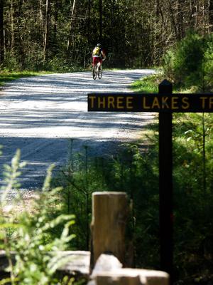
This is the main trail through the valley which stretches from the Cold Mountain parking area to the Salt Rock parking area. It passes near many of the main attractions within the valley, so many loop rides will utilize it. The surface is generally...
Confusingly, this trail is neither a loop nor is it really in Pilot Cove - rather it runs along a ridge, Forked Ridge at first and then Slate Rock Ridge. But it does start in Pilot Cove, on the Pilot Cove-Slate Rock trail not far from FS 1206, so...
Fun creekside trail, rocky and rooty sections. There are several stream crossings and some small waterfalls on the creek. Steep sections as it goes over the gap on Slate Rock Ridge. Watch out or you will end up on the Laurel Mountain trail at...
This trail is a blast and is nearly always ridden downhill. It's steep, with many sharp switchbacks. Very rocky; has a rock garden that's nearly impossible to ride, and many waterbars. Test out your suspension here! Great views from the top of Pilot...
Fun, moderately technical and moderately climbing loop. Follows Bent Creek closely along its lower portion; this part is true singletrack with some of it on old roadbeds. Rest is mostly doubletrack on old road beds; some graveled portions. Fast, with...
Seasonal Use Only. Note: only north half of loop is open to bikes. Rhododendron & Mtn. Laurel tunnels. Trail travels through some open fields on old, narrow roadbed. Undulates up and down near beginning at picnic area; then drops thru a fun...
Short but fun trail. West of Joanna Road, there are some twisty sections, rollers, and moderate climbs. There is a neat rock feature with a technical and an easy option. East of Joanna Road, the trail descends gently on an old road bed with a few...
This greenway path/trail follows the route of old US Hwy 70 on a steady grade up the Blue Ridge Escarpment from the valley near Old Fort to the top near Ridgecrest. It's a strip of asphalt down the old concrete roadway. Hemmed in by a hardwood and...
Formerly called the Green Creek trail. Passes near Riding Ford, Jawbone, and Warden's falls. Can be used with Powerline Road, Devil's Elbow, and Panthertown Valley trails for a great loop.
Shorter loops possible using connector trails. Some lakeshore riding, lots of hilly interior riding with a few steep, challenging spots. Has lots of great jumps. Has a few creek crossings, one of which is done on a brand new bridge. Sections are...
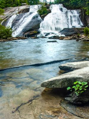
Provides access to the base of High Falls. An old road bed leading along the river fades into a narrower path before ending at the pool below the falls. Rocky in spots near the base of the falls.
As its name implies, this trail follows the river (South Mills) and Bradley Creek, both of which you cross several times. Scenic. Expect to get wet up to your knees on this one. Few hills, some rocky and rooty sections. Impassible in high water.
Most of this trail was turned into a road during 2005. From Ledford Gap to Boyd Branch Road, it is a gravel road and will be permanently maintained that way. Not a trail. From Boyd Branch Road to Ingles Field Gap, it is currently an unimproved road...
Follows a small creek through young, mixed forests with plenty of the usual rhododendron and mountain laurel. Has recently been re-graded with some new bridges installed. Some parts are steep and some technical sections remain.
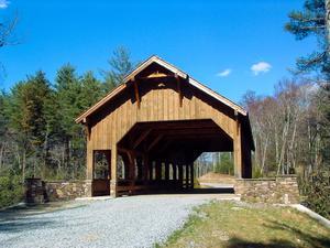
Open and flowing "lollipop" loop with a few short climbs and descents, a covered bridge, and optional features. Longest trail at Jackrabbit Mountain. At the "tip" of the loop, you're only about 1/10 mile north of the GA state line.
This is a stream side trail along an old road bed for much of its length; pulls away from the river along one section around High Falls. Some roots and rocks spice up the ride here and there. Crosses the river using bridges (concrete and suspension)...
The upper end of this trail, above FS 5097 (Neverending Road), was recently rerouted onto a much more reasonably graded trail. It is now more of a flowing trail, albeit with some deliberately placed rock gardens and a few other features to spice up...
Connects Wash Creek Road to the Trace Ridge trail. Running just below the Blue Ridge Parkway, this trail is hilly and somewhat rocky. One steep part toward Wash Creek Road. Slightly overgrown. I've seen deer on this trail twice.
This is a long, backcountry trail. It's purpose-built trail that doesn't follow many logging roads - a rarity in Pisgah. It's excellent - fast, technical, and fun narrow singletrack clinging to the mountainside in most places.
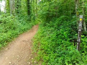
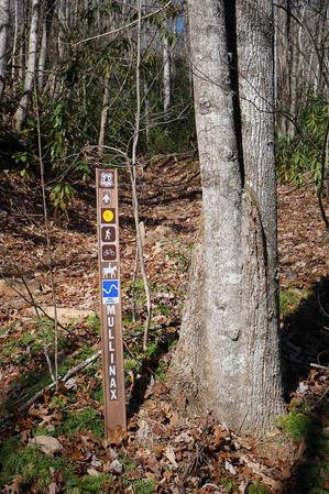
Intersects Mullinax,...
**Note**: major maintenance work was started on this trail in Fall 2015 and the Forest Service has announced its closure to horses and bikes while that is completed. Expected re-opening is March 2016.
This trail is typically ridden in the downhill...
Short connector from Sycamore Cove to Thrift Cove/Grassy Road. Only this portion is open to bikes (not the portion connecting down to Black Mountain trail).
Extremely poorly designed at NC 215 (east) end. Extremely steep. Rest of trail generally follows old roadbeds; very wet & muddy in places. Provides access to the spectacular Courthouse Falls, which is well worth the few hundred foot side hike down to...
Substantial climbs with technical, short but very rooty sections. A fun downhill with several creek crossings - on one the trail becomes the creek for a few dozen feet. Wintertime views of Brevard.
A nice short ride through the woods, but don't expect a view like the name might suggest. There's not really any rock visible on the small mountain known as Table Rock, and it is all tree-covered.
Some stream crossings and old logging roads. Mixed pine and hardwood forests at Tsali are easily recognized on this trail. Some old homesites. Neat part of forest with tall hemlocks and rhododendron, not typical of the heavily logged areas at Tsali....
From Lake Dense, the trail follows an old road bed past the picnic shelter, across the dam, and over to Lake Alford. It has moderate grades, and goes through a pine/hemlock forest where many of the hemlocks are dying. There is a great view of Joanna...
Uphill from the Trace Ridge trailhead parking lot, this trail follows an old roadbed to the parkway. It is a rocky trail: either a fast, bumpy downhill, or a steep, technical uphill. Highly recommended!
Downhill from the trailhead, this trail was...
**Please note:** Only open to bikes from Buck Forest Road down to the Triple Falls picnic shelter and overlook. The portion open to bikes is an old gravel road which descends moderately to the picnic shelter and falls. Closed to bikes beyond the...
This old road is reverting back to a singletrack trail. The new extension from Pinnacle Mountain Road down to Briery Fork trail (built early 2013) is purpose-built singletrack, and it opens up more possibilities for loops in the south end of DuPont,...
Long ridgeline trail which undulates up and down over the various knobs on its summit. Very steep in places; has some issues with erosion as well. It winds onto the edge of private land in places; stay on the trail. Enables a connection with trails...
Starting at FS 74, climbs moderately on a wide old road bed through a couple of switchbacks, first to the right and then to the left. Be sure not to take any mis-leading side trails leading away from the switchbacks on the old road. Traverses the...
Small obstacles such as rock crossings and tighter turns. Has a few short climbs and descents. You'll hear other hikers and riders below you on the Central Loop, which is not far down the slope from you at most times.
From FS 74, this trail descends a little over 1000' to cross Walker Creek and terminate. It is nearly always ridden downhill; the other direction would be a long push more or less. It's muddy after rains and it's rocky, the rocks get slick, and it...
Short connector from Hendersonville Reservoir Road, FS 142, to the Trace Ridge trail on an old road bed. Crosses a small seep and passes into a recently logged area near the junction.
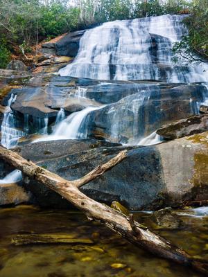
Easy ride on an old road from Tarklin Br. Rd. to Sandy Tr. Narrows a bit, then narrows a lot. Leave your bike at the sign/horse tie-out and take the short, narrow, rough trail for a few hundred feet up over some rocks to the base of the falls.
Travels through the relatively flat stream bottoms at the base of the mountains. Near the western end of this trail, you can see the hills rising out of the valley, and you'll start to climb them before you reach Ledford Branch Road. There used to be...
Longest loop in the park. Crosses a creek and heads into the outer regions. Fun, twisty sections. More difficult than the blue loop, but still moderate overall.
Great views. Has a bit more ups-and-downs and rocky areas than some of the other trails. Travels through some neat, open woods on the east side of the hill. Seems to get less use, so it's a bit narrower too. Provides access to High Point trail.
Formerly known as Kitsuma or Kitsuma Peak. Starting at its upper end, the trail ascends gently beside I-40 before climbing more steeply through a set of 12 switchbacks approaching the peak, gaining 500ft elevation from the parking area. There are...


")