Sycamore Cove Ride

One of the classic rides in Pisgah, Sycamore Cove is not too difficult simply because it is short, but it does have some significant climbs and technical sections to spice it up. It features several creek crossings, technical climbing, some tight singletrack, and a fairly steep, technical, fast downhill to round out the ride. Not to mention occasional views and beautiful stream-side scenery. It makes a great first real mountain biking excursion without being too remote, an "Intro to Pisgah" type ride if you're visiting, an after-work exercise outing, or starting point for assembling a longer ride using other trails in the vicinity.
At A Glance
 4.3 mi round-trip
Difficulty Rating: 5.79 ![]()
Tread Condition: Some Obstacles ![]()
Climb: Hilly ![]()
Climb Total: 600 ft
Configuration: Loop
Starting Point: Davidson River Campground, Art Loeb Trailhead Parking Area
Trails Used: Art Loeb Section 1, Sycamore Cove, Estatoe
Directions
From Asheville, take I-240 west to I-26 east to exit 40 for the Asheville Airport/NC Hwy. 280. Turn right onto NC 280; follow this 4-lane highway for 16 miles toward Brevard. At the intersection with US highways 276 and 64, turn right onto US 276 west (there are signs for Pisgah National Forest). Go 1.3 miles on 276, past the big stone entrance gate. Turn left at the Davidson River Campground entrance. Park in the Art Loeb trailhead parking area, immediately on the left after turning toward the campground.
Overflow Parking: If the Art Loeb trailhead parking is full, you can continue up US 276 200 ft. to the Black Mountain/Thrift Cove parking area on the right. If that's full, continue up US 276 another 0.2 mi. to the Pisgah District Ranger Station for even more parking spaces. From just west of the the Ranger Station parking lot's access road, a gravel Forest Service road leads parallel down US 276 to the Art Loeb trailhead - a safer route than the highway.
Details
Ride Description
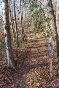
Begin the ride on the short section of the Eastatoe/Art Loeb trail which parallels US highway 276 heading east at the back of the parking area. It's nearly level, mostly gravel, and follows the Davidson River downstream, passing under some power lines. At the steel arch bridge, Art Loeb and Estatoe trails go right over the river. Continue straight and cross the smaller wooden bridge over Starens Branch, then make an immediate left onto the trail leading toward US 276.
Cross US 276 and take the Sycamore Cove trail on the other side. Use caution when crossing - this is a high-speed zone.
You'll start following Starens Branch throught the woods in the flat Davidson River floodplain. The trail crosses a small boardwalk over a wet area, then enters a side cove where the sound of Hwy. 276 traffic is soon left behind except for the loudest motorcycles.


The trail begins climbing over some very technical rooty sections, and it begins following Starens Branch, which it will cross. You can either ride through the water or use the small log bridge. The log bridge is old and getting pretty sketchy as of early 2017.
Interestingly, there is nothing on the map named Sycamore Cove in this vicinity. There are some sycamore trees beside the Davidson River, and the floodplain and picnic area just downstream is known as Sycamore Flats. Perhaps the second cove, where you'll end the ride, and which doesn't have a name on the map, is or was known as Sycamore Cove.
The trail passes right by a small cascade on Starens Branch, then starts uphill in earnest, becoming quite steep at times. It is heavily eroded through here. It passes an old concrete structure of some kind on the right, then switches back to the left as it climbs along the side of the cove. Another switchback to the right is at the junction with the Starens Branch trail, which leads a short distance up to the Thrift Cove and Grassy Road trails.
Past the second switchback, you resume the climb. This stretch is moderately technical with a couple of very steep pitches. It follows a route that takes it parallel to and just below the Grassy Road trail, but there's no way up to it past Starens Branch. (You can use the Grassy Road trail as an alternative to this climb if you prefer a less technical route).
Sycamore Cove turns right, crosses the stream on a small bridge, and begin pulling away from the stream uphill through a cool side cove. You'll soon reach the upper intersection with the Grassy Road trail on the left in a white pine grove. The Sycamore Cove trail turns right and continues climbing through a dry cove, then reaches its northernmost point to curve south onto the side of the ridge on an old logging path. The climb moderates considerably here.


The climb tops out after a fun sidehill stretch of trail and you begin the downhill. For about the next mile, the trail is fast, bumpy with lots of roots, and fun.
Close growing mountain laurel forces you to stay alert and contort your body to avoid colliding with it at high speed. Parts of the trail wind into small side coves filled with Appalachian hill cane, a neat low-growing native bamboo.
A wintertime view of Brevard can be seen on the right at one point after you round the nose of the ridge. Although the trail is a gentle descent along much of this stretch of the ride, it does have a few very short climbs thrown in for good measure.
You might even be able to hit a banked turn or two if you keep your speed up. Watch for other trail users, though, as hikers are also allowed to enjoy this trail, as with all multi-use trails in Pisgah.
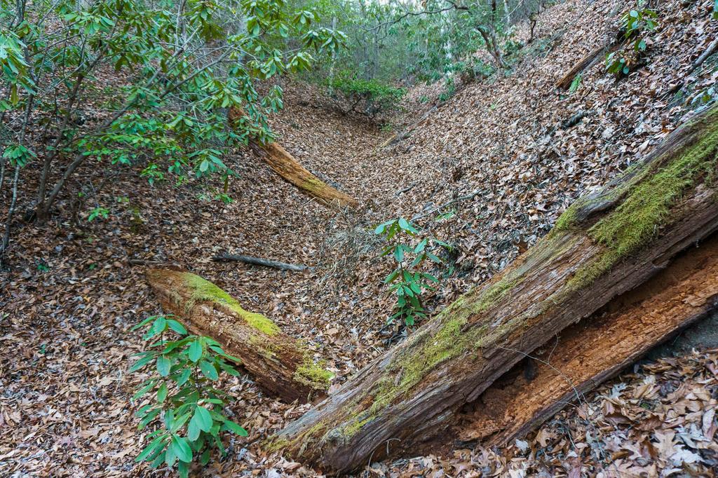
The trail soon turns briefly north again, where it begins descending a bit more steeply. Rhododendrons thicken, and the trail reaches a few technical sections and a tributary crossing.
At the tributary, the trail clings to the side of the gulch carved into the side of the mountain, adding to the exposure and the fun of the descent.

The trail then dives steeply into a cove at a switchback where it begins heading south again. You'll cross the unnamed stream in this cove a total of 6 times on this final stretch of trail. One of the crossings is on a footbridge, a couple have stone bridges, and at least one will probably get you wet.
The trail is all downhill towards the highway, and moderately technical in places. Banked curves into the eroded hillsides also encourage a little flow-style riding. As the trail flattens out and makes the last creek crossing on a stone bridge, you'll know it's almost time to pop out of the cove onto the highway, so use caution as traffic is heavy.
The final few yards of the trail pass through a remnant hemlock forest, giving you a tiny peek at what the entire cove used to look more like. Sadly, all the hemlocks farther up the cove are now dead. It's a much more open feeling than in years long past.

Cross US 276, and turn right to head back to the trailhead parking. You can ride the road, or follow the wide fisherman's path on the river side shoulder where there is a bit of a buffer between you and the traffic whizzing by. Bear left onto the connector to the Art Loeb/Estatoe trail, and follow the level path back to the parking area to end the ride.
Ready for more? If it's between October 15 and April 15, maybe consider adding the North Slope trail through the campground, or cross US 276 again and pick up the Thrift Cove or Black Mountain trails, which can be combined into another loop. From there, there are many other options so study a map to assemble an even longer ride!
All Photos from This Ride


Ride Landmarks
| Mileage | Directions |
|---|---|
| Start | Ride the Art Loeb/Estatoe trail downstream along the Davidson River. Go past the arch bridge on the right, cross the small log bridge, and then turn left. Cross US 276. Be wary of the traffic! |
| 0.4 | Straight onto the Sycamore Cove trail. |
| 1.0 | Switchback, then signed intersection with Starens Branch. Turn sharply right, uphill, staying on Sycamore Cove trail. |
| 1.7 | Intersection with the Grassy Road trail. Turn right; still the Sycamore Cove tr. Stiff climb. |
| 2.1-2.2 | Top of climb. Trail begins downhill fun. |
| 3.7 | US 276. Turn right. |
| 3.9 | Bear left toward Art Loeb/Estatoe trail arch bridge. Continue straight back toward the parking area. |
| 4.3 | Finish. |
Map
Green highlight indicates the route to follow within the trail network for this ride.
Tip: Printing this map? You can pan and zoom the map as desired before printing to show the area you need.
Map Information
Download GPS Data
Click on a route, trail, or point on the map and select the GPS Data tab to download its data.
Data Formats
KML (Google Earth)
KML is the main file type used by Google Earth. If you have Google Earth installed, clicking the KML link should open the trail or point directly in Google Earth for viewing. This is the native file format used by Google Earth, but many other map applications can use and understand KML as well, so if you're not sure which one to download, KML is a good bet.
GPX
The GPX format stands for GPS Exchange - a free, open, XML format for exchanging GPS and map data. GPX is compatible with Google Earth, many other mapping programs, and most GPS devices (such as Garmin). Load the file directly into your GPS to help find your way on your next trip!
GeoJSON
GeoJSON is a newer, lightweight data exchange format which can be used to quickly share map data and may have a smaller size than KML or GPX. Many professional mapping and GIS applications support the GeoJSON format.
About the Map
Copyright
Base Layers
Base layers provided by OpenStreetMap, the US Geological Survey, the US Forest Service, and NC OneMap. Base layer images are subject to the respective copyright policies of their owners. Base layers may not be available at all times due to system maintenance or outages.
WNCOutdoors Base Layer
The WNCOutdoors Base layer is provided by WNCOutdoors.info. It is licensed by Creative Commons Attribution 3.0.
Trail and Marker Overlays
Trail layers and downloadable data are all original works created by WNCOutdoors with guidance from a variety of sources, including ensembles of our own GPS tracks, user contributed GPS tracks, official maps and GIS data from government agencies, and field observations. WNCOutdoors data is made freely available under the Open Database License - you are free to copy and use it for any purpose under the terms of that license (summary).
Tips
- Hover over a trail to see it highlighted. Helps to see start and end points for an individual trail.
- Scroll and zoom the map before printing, and that view will persist into the printed image.
- Click a trail for more details and to download it individually.
Feedback
Ratings
Average Rating: 4.0 (rated 2 times)
Rate It Now:

kristy miller said: Hi, If dry, will the trails be open the weekend of February 3rd - 5th?
kurtis said: A very nice trail in terms of setting and scenery, but the down hill is very BUMPY. Maybe if I rode it more I would be more comfortable, but it is so bumpy that I have to control my speed tightly to insure that I can stop since I didn't know the trail. I would rate as only 3 stars. I would ride the North Slope trail across the street in both directions before I rode this one again.
Dan said: I rode this trail as a first-time trail in North Carolina. I rode Grassy Trail on the up-hill and then took the leg of Sycamore closest to the entrance as the downhill. Grassy Trail is wide and non-technical, but it was a real workout to someone who normally rides in Central Indiana where there are pretty much no climbs. I thoroughly enjoyed the downhill although I had to clip-out several times for some of the steeper root- and creek-crossings.