Going uphill, starts in a clearing, and then becomes a fairly technical and moderately steep route. Recommended direction is downhill, however, and you can make a nice loop using FS 5001 (a gated logging road).
Follows one of the larger tributaries of the North Mills River. Many creek crossings on the lower half. Steep climb up the Pisgah Ridge on the upper half. High elevation change. Carry bikes across Blue Ridge Parkway property.
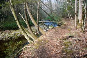
Fun creekside, backcountry trail. Numerous water crossings (the deep, rocky, wading type). Good trail for a hot day. Log after log after log across the trail (touch up on your bunny hopping skills!). At some of the creek crossings, it is difficult to...
Connects the South Mills River trail with the middle of Squirrel Gap trail. Starting near the old Cantrell Creek Lodge site, the trail follows Cantrell Creek upstream on the river right side to where the former trail continues upstream (now part of...
Passing through some open fields which have been used to grow corn in the past, the upper part of this trail makes a very fun downhill: it's fast, gradual, winding, and just steep and bumpy enough to spice it up. Fields can get overgrown with weeds...
A little overgrown with doghobble, but an otherwise nice trail; climbs by a creek in a scenic deep cove, then the narrow trail climbs up small, steep ridge. Some erosion on ridge.
Long, narrow, backcountry singletrack trail which reaches high elevations. Overall, it's a gradual climb but it does feature some very technical spots and steep climbs. In addition to that, there are fast sections where you can stay in the middle...
Traveling beside Middle Fork (stream) and crossing it once on an old railroad grade, the upper section is moderately sloped and bumpy with one section that has many logs laid across the trail side by side for erosion control. The lower section is a...
From the S. Mills River trail, climbs on an eroded old roadbed through nondescript forest to a nice campsite in a gap, just after crossing a small stream. Technical in spots. The trail makes a hard right to the north on another road bed, which heads...
Fairly level but technical and has many river crossings where the trail is difficult to follow. Very little riding and a lot of wading. Impassible in high water.
Confusingly, this trail is neither a loop nor is it really in Pilot Cove - rather it runs along a ridge, Forked Ridge at first and then Slate Rock Ridge. But it does start in Pilot Cove, on the Pilot Cove-Slate Rock trail not far from FS 1206, so...
Fun creekside trail, rocky and rooty sections. There are several stream crossings and some small waterfalls on the creek. Steep sections as it goes over the gap on Slate Rock Ridge. Watch out or you will end up on the Laurel Mountain trail at...
This trail is a blast and is nearly always ridden downhill. It's steep, with many sharp switchbacks. Very rocky; has a rock garden that's nearly impossible to ride, and many waterbars. Test out your suspension here! Great views from the top of Pilot...
As its name implies, this trail follows the river (South Mills) and Bradley Creek, both of which you cross several times. Scenic. Expect to get wet up to your knees on this one. Few hills, some rocky and rooty sections. Impassible in high water.
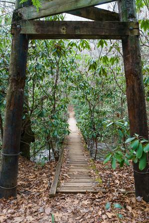
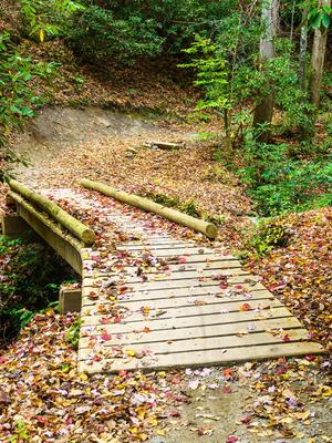
This is a stream side trail along an old road bed for much of its length; pulls away from the river along one section around High Falls. Some roots and rocks spice up the ride here and there. Crosses the river using bridges (concrete and suspension)...
The upper end of this trail, above FS 5097 (Neverending Road), was recently rerouted onto a much more reasonably graded trail. It is now more of a flowing trail, albeit with some deliberately placed rock gardens and a few other features to spice up...
Connects Wash Creek Road to the Trace Ridge trail. Running just below the Blue Ridge Parkway, this trail is hilly and somewhat rocky. One steep part toward Wash Creek Road. Slightly overgrown. I've seen deer on this trail twice.
This is a long, backcountry trail. It's purpose-built trail that doesn't follow many logging roads - a rarity in Pisgah. It's excellent - fast, technical, and fun narrow singletrack clinging to the mountainside in most places.
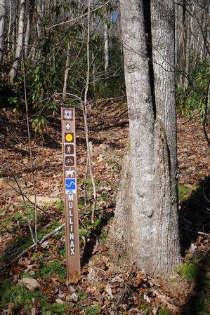
Intersects Mullinax,...
Uphill from the Trace Ridge trailhead parking lot, this trail follows an old roadbed to the parkway. It is a rocky trail: either a fast, bumpy downhill, or a steep, technical uphill. Highly recommended!
Downhill from the trailhead, this trail was...
Long ridgeline trail which undulates up and down over the various knobs on its summit. Very steep in places; has some issues with erosion as well. It winds onto the edge of private land in places; stay on the trail. Enables a connection with trails...
Short connector from Hendersonville Reservoir Road, FS 142, to the Trace Ridge trail on an old road bed. Crosses a small seep and passes into a recently logged area near the junction.
This heavily-used trail features incredible views, riding along a needle-sharp ridgeline, and lots of rock outcroppings and boulders. The trail itself is notable for its waterbars, switchbacks, and (unfortunately) heavily eroded sections. Either...
Many creek crossings on the lower end and then it's a stiff, moderately technical, rocky climb to the gap. Some eroded places and waterbars. Merges with and follows a gravel road near the top. Not ridden N. of Buckhorn Gap down to S. Mills R. See...
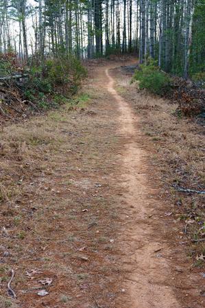
This is an excellent, easy trail, and a great loop for beginners wanting to sample some singletrack riding, with low elevation changes. It travels through a forest of mostly white pines with an understory of mountain laurel and a vast cover of ground...
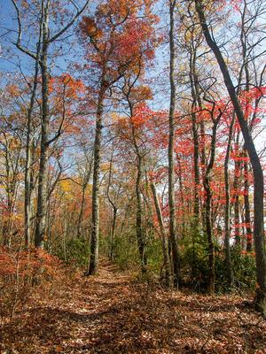
Seasonal Use Only. Note: only north half of loop is open to bikes. Rhododendron & Mtn. Laurel tunnels. Trail travels through some open fields on old, narrow roadbed. Undulates up and down near beginning at picnic area; then drops thru a fun...


")
