Mountain Biking in Western North Carolina
The mountainous western part of North Carolina is a haven for outdoor recreation enthusiasts.

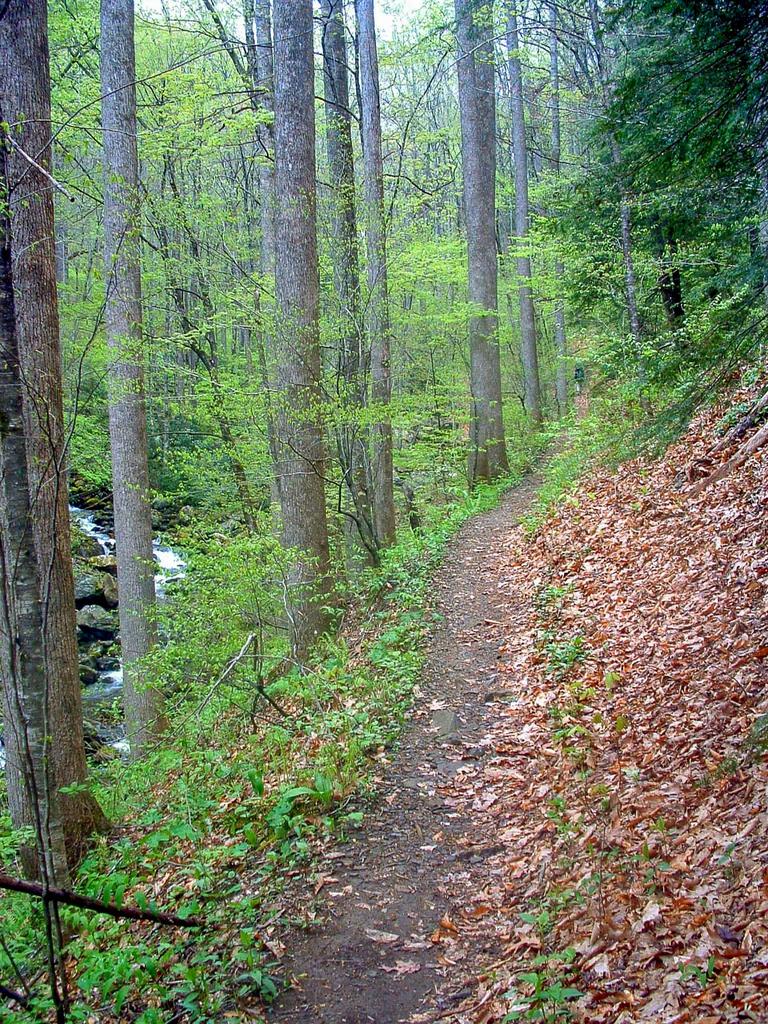
Some of the highest peaks in the East, surrounded by vast areas of public land and miles and miles of trails, invite mountain bikers to visit from all over the world. But even locals looking for a quick, easy ride find the area irresistible.

Why take an expensive vacation thousands of miles away when a world-renowned outdoor playground is right next door?
MTB WNC is your on-line mountain biking guide for the Mountain region of North Carolina, containing all of the information you need to make your next trip complete. We aim to provide guidebook-quality information that you can use in your outdoor persuits. Have fun browsing and riding!
On This Site
Trails
The Trails section is dedicated to the individual trails in Western North Carolina. Use this section to search for a trail if you know its name. Each trail has its own page with all the details, a map (where available), and a place to leave ratings and comments.
Featured Trails: Estatoe, Cove Creek, Yotee's Run, Cedar Rock...
Trailheads
MTB WNC's Trailheads are hubs or larger areas where several trails are clustered together or in a network. Each represents a place where you can spend a day or more exploring mountain biking trails without driving too far (or at all!).
Featured Trailheads: Pisgah National Forest, Nantahala National Forest, Dupont State Forest...
Best Rides
The Best Rides combine the individual trails from the Trailheads above into a fully guided experience. We feel like these trips are most representative of the great mountain biking that Western North Carolina has to offer!
Featured Hikes: Black Mountain, Daniel Ridge, Eastern Slickrock, Tsali...
Maps
This section covers all of the maps we have available for you to view, download, and purchase, including maps of the Trailheads and Best Rides above, and interactive Google Maps with downloadable GPS data.
Featured Maps: Interactive Map of Trailheads, USGS Topographic Maps, Nat. Geo Trails Illustrated ™ Series...
Photo Gallery
Browse through photos of the trails, views, waterfalls, and mountains in the region. Links to these galleries are provided from Trailheads and Rides as well.
Featured Galleries: Dupont State Forest, Flat Laurel Creek, Picklesimer Fields, Tsali, Black Mountain...
Area Information
Get general area information to round out your trip, including things to consider when planning a ride, information about places to stay and bike shops, and ways to get involved in the area's mountain biking community.
Area Information Pages: Camping/Lodging, Bike Shops, Geography, Weather/Climate, Clubs & Organizations...
Connect With Us!
Have questions, comments, criticisms, suggestions, trail info, or errors to report? Contact us and we'll be back in touch with you! Or use one of these other ways to get in touch.
|
|
 WNCOutdoors.info Blog |
Site Updates & News
New Bernard Mountain Trail set to open June 16 in Old Fort, NC
The National Forests in North Carolina has announced the opening of a new 3+ mile trail near Old Fort, NC! This new trail will provide loop opportunities with the existing Young’s Ridge and Point Lookout Greenway trails in the immediate … Continued
Posted on June 11, 2023 8:03 pm
Panthertown’s Cold Mountain Trailhead to be Closed, Expanded
Edit: As of August 7, the parking area is finished and open again. Enjoy! Panthertown Valley’s Cold Mountain trailhead, providing the best access to some of the area’s favorite features such as Schoolhouse Falls, will close on Monday morning for … Continued
Posted on August 1, 2015 10:59 am
Tsali User Group Schedule is Changing
For the first time I can remember, the schedule for which users can use which trails at the Tsali Recreation Area, located on Fontana Lake near Bryson City, NC, is changing. The press release says the schedule will be posted … Continued
Posted on April 25, 2015 10:24 am
North Mills River Trails Reopened
Most of the trails and roads which were closed for the Brushy Ridge logging project have reopened today, according to the National Forests in NC. The roads and trails were closed while logging took place in the area, and while … Continued
Posted on June 18, 2014 9:46 pm
15 Miles of Multi-Use Trails Open Saturday at Lake James State Park
Western North Carolina is about to have yet another trail system for mountain biking at one of its beautiful mountain destinations! Lake James State Park will soon be open to bikes with 15 miles of new multi-use trail on the north … Continued
Posted on June 5, 2014 10:28 pm
Black Mountain Trail Needs Your Help!
The lower section of the Black Mountain trail – below its northern intersection with the Thrift Cove trail – will be closed for at least two weeks while the “Big Dig 2014” trail work project gets underway. The project, which is being … Continued
Posted on May 20, 2014 9:28 pm
Santeetlah Lake Trail Now Open
Tucked away near Robbinsville, NC in Graham County is Santeetlah Lake, a gem of a reservoir with a name I’ve yet figured out how to pronounce correctly. The lake is fed by clear, cold-water streams such as Snowbird Creek and one … Continued
Posted on April 17, 2014 3:43 pm
Archived news and more articles are on the WNCOutdoors.info Blog.

