Mountain Biking Richmond Hill Park, Asheville, NC
A multi-use trail system is nearly complete at Asheville's Richmond Hill Park, on hills overlooking a bend of the French Broad River northwest of town. Built within the last few years, these trails have been a great way to show that the city serious about its plans for outdoor recreation on city land.


The Trails
The trails were purpose built with mountain bikers in mind; however, they're open to both mountain bikes and hikers. On a recent trip, I saw dozens of hikers and one mountain biker using the trail. You'll often find families and dog-walkers on the trail, so keep that in mind if you're coming here for a ride.
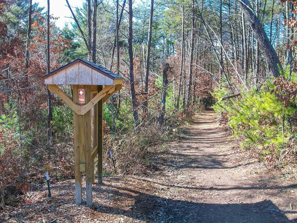
The trail system currently consists of about 5 miles of signed trails on both old road beds and purpose-built paths. Trails twist along the piney hilltops, pass through the disc golf course, and dip down into a couple of creek bottoms near the railroad tracks and the French Broad River for a unique experience.
Overall, trails are "tight and twisty" in character. They were designed this way on purpose both to provide that type of experience which isn't found elsewhere in the region; to encourage bikes to slow down and share the trails with other users; and to fit as much trail mileage into the small amount of land as possible. Whether you're here to kill some time, get some exercise, or hone your bike handling skills, you'll find the trails here suitable.
The Yellow blazed trail is the main route through the park, about 3.1 miles long. It forms a loop. The **Blue* blazed trail is a "lollipop" loop that heads south off the Yellow trail. here are 4 short Red blazed trails that connect various segments of the yellow trail together, making alternate loops possible.
See the full photo gallery of Richmond Hill Park.
Directions
From downtown Asheville, NC, take Montford Ave. north across I-240 and turn left immediately onto Hill St. Follow Hill St. for 1 mile to Riverside Drive and turn right. Go 0.9 mi and turn left onto Pearson Bridge Rd. Go across the river; in 0.3 mi., turn right onto Richmond Hill Dr. (inside a sharp right-hand curve). Follow Richmond Hill Dr. to its end in 0.9 mi, bearing right at the top of the hill. At the roundabout, take the first drive to the right into the parking area.
It's just over 3 miles from downtown to the park, so you could ride there if you're already downtown.
The trails start behind the sign board on the left side of the parking area as you came in.
Trail Maps
Official City of Asheville Trail Map
Here's the city's official trail map of Richmond Hill Park. It's a PDF, so you can load it up on your phone or print it out and take it along.
Our Interactive GPS Map
Map Information
Download GPS Data
Click on a route, trail, or point on the map and select the GPS Data tab to download its data.
Data Formats
KML (Google Earth)
KML is the main file type used by Google Earth. If you have Google Earth installed, clicking the KML link should open the trail or point directly in Google Earth for viewing. This is the native file format used by Google Earth, but many other map applications can use and understand KML as well, so if you're not sure which one to download, KML is a good bet.
GPX
The GPX format stands for GPS Exchange - a free, open, XML format for exchanging GPS and map data. GPX is compatible with Google Earth, many other mapping programs, and most GPS devices (such as Garmin). Load the file directly into your GPS to help find your way on your next trip!
GeoJSON
GeoJSON is a newer, lightweight data exchange format which can be used to quickly share map data and may have a smaller size than KML or GPX. Many professional mapping and GIS applications support the GeoJSON format.
About the Map
Copyright
Base Layers
Base layers provided by OpenStreetMap, the US Geological Survey, the US Forest Service, and NC OneMap. Base layer images are subject to the respective copyright policies of their owners. Base layers may not be available at all times due to system maintenance or outages.
WNCOutdoors Base Layer
The WNCOutdoors Base layer is provided by WNCOutdoors.info. It is licensed by Creative Commons Attribution 3.0.
Trail and Marker Overlays
Trail layers and downloadable data are all original works created by WNCOutdoors with guidance from a variety of sources, including ensembles of our own GPS tracks, user contributed GPS tracks, official maps and GIS data from government agencies, and field observations. WNCOutdoors data is made freely available under the Open Database License - you are free to copy and use it for any purpose under the terms of that license (summary).
Tips
- Hover over a trail to see it highlighted. Helps to see start and end points for an individual trail.
- Scroll and zoom the map before printing, and that view will persist into the printed image.
- Click a trail for more details and to download it individually.


